It was 1909 - 100 years ago - when the first car of the Washington, Baltimore and Annapolis Electirc Railway
rolled onto the streets of Annapolis. Eighty-one years and several paving projects later the tracks were
once again visible along the old cars' route. I lived downtown at that time and took the
opportunity to snap a few pictures, including one of the bizarre curve from King George Street
onto College Avenue.
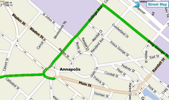
The map, below, shows the route of the tracks in downtown Annapolis. The green lines indicate where tracks were uncovered in the summer of 2000; the tan lines show where the tracks, long since removed, ran along Main and Randall Streets .
All pictures are thumbnails; click on each for a larger picture, which will open in a new window.
|
|
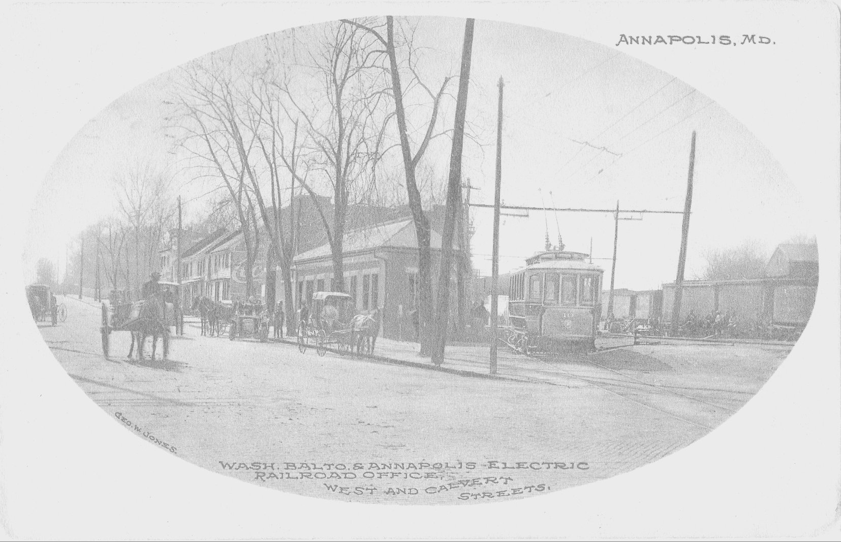
The station at West and Calvert Streets. WARNING: linked photograph is
EXTREMELY large to show as much detail as possible and may take some time to download on slower connections.
|
|
|
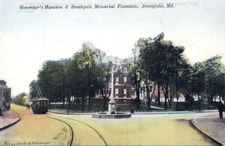
This unused postcard shows a car, on its way out of town, coming down College Avenue toward Church Circle.
Note that, though the trolley poles are up, there are no wires. Artistic license, I suppose,
since the subject of the card is not the srteetcar but the fountain and Governor's Mansion.
|
 |
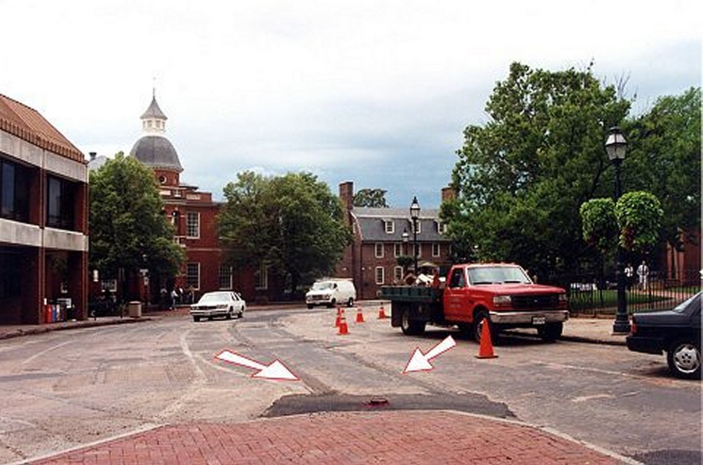
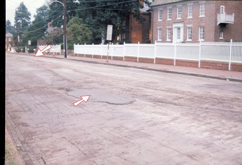
The wye at Church Circle and West Street. The arrows point out the
barely-visible rails. |
 |
Another view of the wye at Church Circle and West Street. |
 |
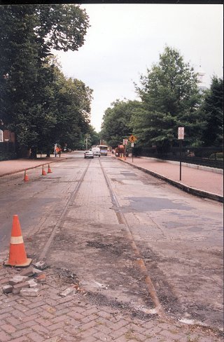
The curve from Church Circle down Main Street. The tracks down Main Street
were removed when that street was repaved in the 1990s.
|
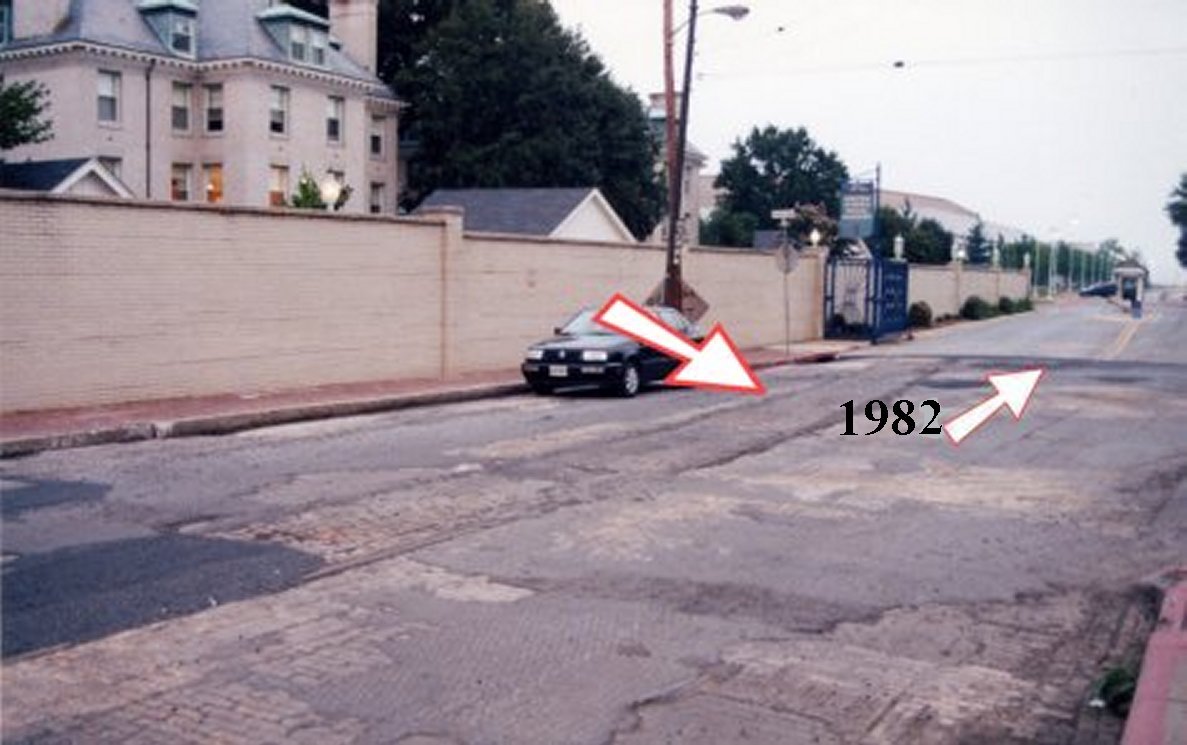 |
| The remaining track near Gate 1 of the U.S. Naval Academy veers to the left. In the railroad's heyday the Naval Academy ran along King George Street to the water's edge, and there were two streetcar tracks running along King George Street to a ferry wahrf. The arrow in the larger picture shows where Gate 1 once stood and where the streetcar tracks were uncovered in June 1982 (the arrow near the "1982"shows the approximate location of where the tracks were uncovered). |
 |
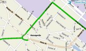
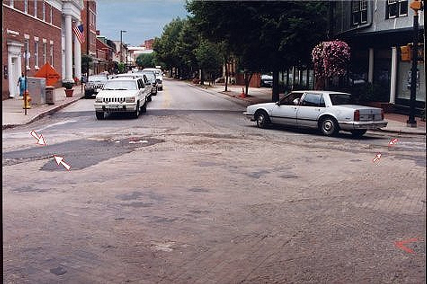
The odd curve from King George Street onto College Avenue. The interurban cars
were too long to manage a regular 90-degree curve, so the railroad built this
question-mark curve.
|
 |
Another view of the odd curve, this one showing a better view of
the question-mark shape of the curve (the upper arrow shows the straight track from King George Street;
the lower arrow indicates unusual "S"-shaped curve).
|
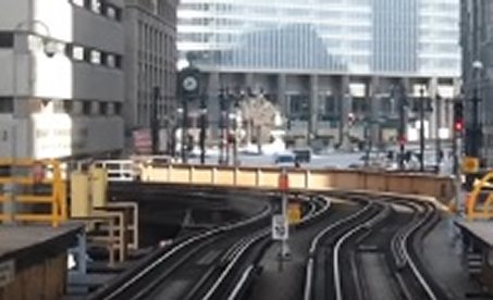 |
A similar curve in the tracks of Chicago's "elll", from the
video, which was shot in February of 2015. The curve appears at
10:55.
|
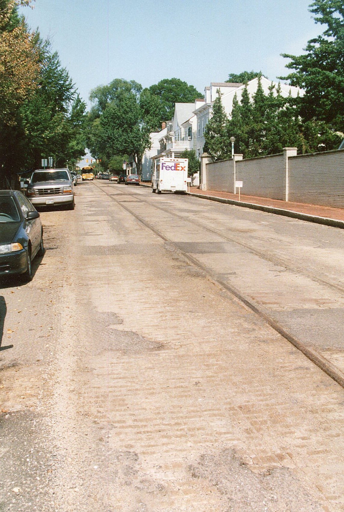 |
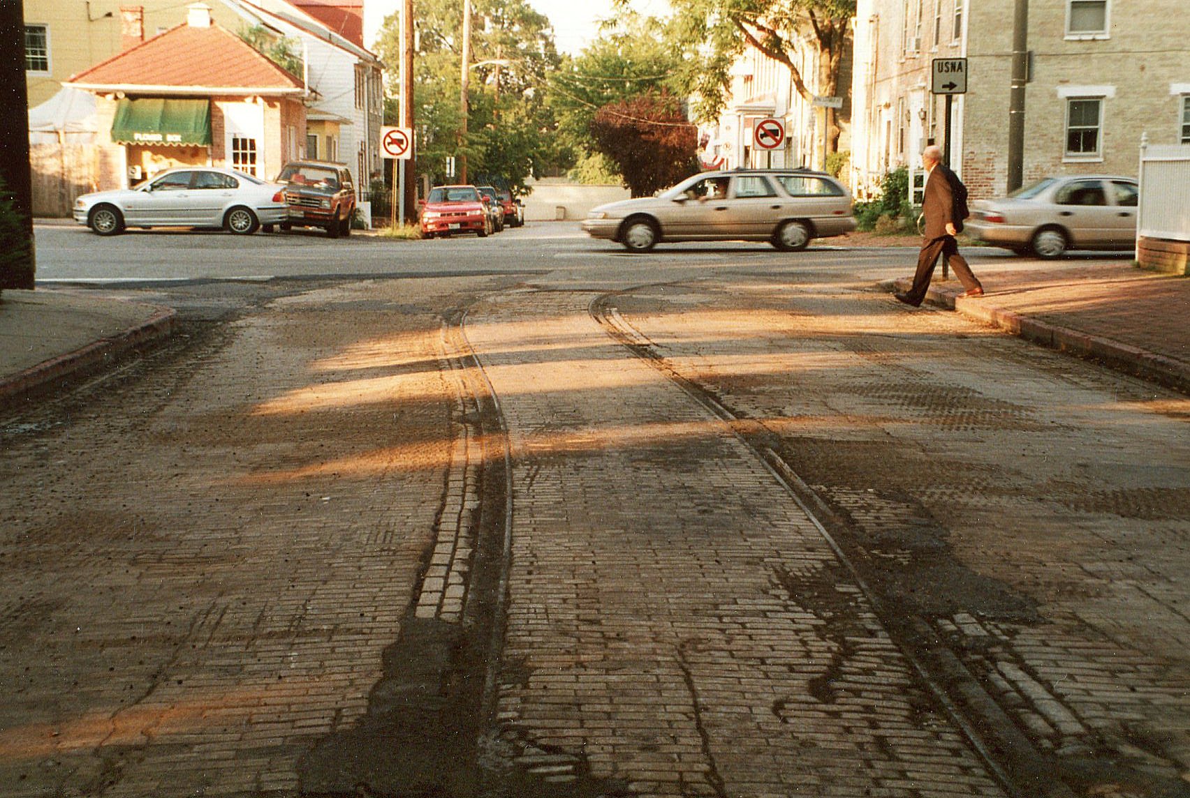
The straight track along King George Street, paralleling the 150-year-old walls of the U.S. Naval Academy.
Almost like being back in 1909 - except for the modern automobiles, patched pavement, brick sidewalks and Fed-Ex deliveryman running across the street..
|
|
A sad but fitting photo to end this brief tour: a car and van are passing
a city transit bus that is designed to resemble the old streetcars, while the tracks of the real streetcars
fade into modern pavement and into history.
|