

From Baltimore/points North: Get onto I-97 South from I-695 and head to Annapolis. Get onto U.S. 50 East and follow to exit 23, MD 450. Take exit 23 to MD 450 (West Street); bear left at the fork in the ramp. Turn left onto West Street. Follow West Street approximately 1.5 miles.
From the East: Take U.S. 50/301 across the Chesapeake Bay Bridge. Follow U.S. 50 to Annapolis, approximately 7.5 miles. Take the Rowe Boulevard exit to ANNAPOLIS. Go to the first light and turn right onto Farragut Road. Follow Farragut to the "T" with Cedar Park and turn left. Take the first right onto Glen Avenue, then follow Glen Avenue to West Street. Turn left onto West Street.
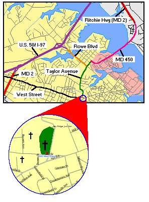
When you get in the area you will pass St. Mary's Cemetery on the right, with a combination wrought-iron/chain link fence; Brewer Hill Cemetery is on the left, enclosed by a brick wall. The Annapolis National Cemetery is just past Brewer Hill, surrounded by a fieldstone wall.